

Volume 4 - 1.0 Purpose And Need For Action
1.0 PURPOSE AND NEED FOR ACTION
This document has been prepared as a joint Environmental Impact Report/Environmental Impact Statement (EIR/EIS) due to the combined local, State, and federal actions associated with the Proposed Project. Co-lead agencies are the County of Riverside (County), pursuant to the California Environmental Quality Act (CEQA), and the United States Fish and Wildlife Service (USFWS), pursuant to the National Environmental Policy Act (NEPA). The following agencies are responsible for the implementation of the proposed MSHCP in their own jurisdiction pursuant to CEQA:
- County of Riverside;
- Riverside County Flood Control and Water Conservation District (Flood Control);
- Riverside County Transportation Commission (RCTC);
- Riverside County Parks and Open Space District;
- Riverside County Waste Management District;
- California Department of Transportation (Caltrans);
- California Department of Parks and Recreation;
- California Department of Fish and Game (CDFG); and
- Fourteen cities in western Riverside (Temecula, Murrieta, Lake Elsinore, Canyon Lake, Corona, Norco, Riverside, Moreno Valley, Perris, Hemet, San Jacinto, Beaumont, Banning, and Calimesa).
1.1 Introduction
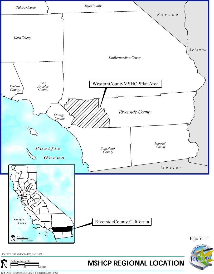
The Western Riverside County Multiple Species Habitat Conservation Plan (MSHCP or Plan) is a comprehensive, multi-jurisdictional Habitat Conservation Plan (HCP) focusing on conservation of species and their associated habitats in western Riverside County. This Plan is one of several large, multi-jurisdictional habitat-planning efforts in Southern California with the overall goal of maintaining biological and ecological diversity within a rapidly urbanizing region. Large-scale HCP planning efforts have been completed in San Diego and Orange Counties and a similar effort is underway in the Coachella Valley. The proposed MSHCP would allow western Riverside County and its cities to better control local land-use decisions and maintain a strong economic climate in the region while addressing the requirements of the State and federal Endangered Species Acts. The proposed MSHCP encompasses approximately 1.26 million acres (1,966 square miles). The proposed Plan Area includes all unincorporated Riverside County land west of the crest of the San Jacinto Mountains to the Orange County line as well as the jurisdictional areas of the cities of Temecula, Murrieta, Lake Elsinore, Canyon Lake, Norco, Corona, Riverside, Moreno Valley, Banning, Beaumont, Calimesa, Perris, Hemet, and San Jacinto (see Figures 1.1 and 1.2). This MSHCP is one of the largest plans ever attempted. It covers multiple species and multiple habitats within a diverse landscape, from urban centers to undeveloped foothills and montane forests, all of which are under multiple jurisdictions. It extends across many bioregions as well, including the Santa Ana Mountains, Riverside Lowlands, San Jacinto Foothills, San Jacinto Mountains, Agua Tibia Mountains, Desert Transition, and San Bernardino Mountains. It would provide a coordinated MSHCP Conservation Area and implementation program to preserve biological diversity and maintain the region's quality of life.

The MSHCP would serve as an HCP pursuant to Section 10(a)(1)(B) of the Federal Endangered Species Act of 1973 (FESA), as well as a Natural Communities Conservation Plan (NCCP) pursuant to the NCCP Act of 2001, as amended. The approval of the proposed MSHCP and execution of the Implementing Agreement (IA) would allow the Wildlife Agencies (USFWS and CDFG) to issue take authorizations for plant and wildlife species identified within the Plan Area to the signatories of the IA. A local, streamlined approach to planning for endangered/sensitive species would result in greater economic development certainty and provide for and maintain biological diversity by creating an interconnected MSHCP Conservation Area in the proposed Plan Area where adequate management and monitoring is assured. With the proposed MSHCP, the Wildlife Agencies will grant take authorization for otherwise lawful actions, such as public and private development that may incidentally take or harm individual species or their habitats outside of the MSHCP Conservation Area, in exchange for the assembly and management of a coordinated MSHCP Conservation Area. In addition to the preservation of species and associated habitats, the proposed MSHCP Conservation Area would provide open space and recreational opportunities, which would enhance the quality of life in Riverside County. The MSHCP's strategy for managing the proposed MSHCP Conservation Area requires a balanced approach. It allocates responsibility for its assembly and long-term management to the County, State, and federal governments, the 14 cities in western Riverside County, and private and public entities engaged in construction activities that would potentially affect the species covered under the proposed MSHCP. The proposed MSHCP acknowledges the obligation of local projects, both public and private, to mitigate their impacts on species. To encourage conservation on privately owned lands, the implementation strategy of the proposed MSHCP incorporates a broad array of incentives. Where incentives are not sufficient, conservation would require the purchase of properties from willing sellers.
1.1.1 Background
Historically, urban development in Southern California has occurred in the coastal areas of Los Angeles, Orange, and San Diego Counties, resulting in a significant loss of important biological resources in the region. The inland valleys and hillsides of Riverside and San Bernardino Counties have, until recently, remained largely rural, agricultural, and relatively undeveloped. Natural habitats that were once common and extensive in Southern California have declined rapidly due to this historic development pattern and to increasing development pressure in the northwestern and southwestern parts of the County over the past 15 years. The burden of mitigating the effects of urbanization now falls largely on the County, the cities, and private landowners who hold much of the last remaining intact habitats in the region. As development pressure has increased, so have conflicts between landowning interests and the State and federal regulatory processes associated with protecting endangered, threatened, and rare species. Conflicts over species conservation threaten the ability of local jurisdictions to plan for and provide the infrastructure necessary for economic development and a high quality of life in the County. As urbanization has increased within the County, an increasing number of proponents of public and private developments have been required to obtain "take permits" from Wildlife Agencies for impacts to endangered, threatened, and candidate species and their habitats. This process, however, has resulted in costly delays in public and private development projects and created an assemblage of unconnected habitat areas on a project-by-project basis. This piecemeal and uncoordinated effort to mitigate the effects
of development does not sustain wildlife mobility, genetic flow, or ecosystem health, which require large, interconnected natural areas. The County's population in 2000 was approximately 1.5 million people (Stanley R. Hoffman & Associates, revised January 2000). Its population is expected to double by 2020, to reach approximately 3.5 million by 2030, and approximately 4.5 million by 2040, according to forecasts by the Southern California Association of Governments (SCAG). This is nearly a 400-percent increase over the next 40 years. Most of Southern California's growth over the next 40 years is expected to occur in the Inland Empire (San Bernardino and Riverside Counties) (SCAG, 2000). Accommodating an increase in population of this magnitude would involve urbanizing thousands of acres of undeveloped land and result in significant conflicts with regulations protecting species and their habitats. Without coordinated planning efforts, conflicts and delays would escalate costs for all development projects, management efforts would not be assured, uncoordinated mitigation efforts would fragment habitats, the region would miss opportunities to improve the quality of life, and economic development opportunities for the current and future residents of the County would also not be realized.
1.1.2 Riverside County Integrated Project
The proposed MSHCP is one element of a comprehensive regional planning effort begun in 1999. To accommodate the County's anticipated growth, the County must provide a range of housing alternatives, encourage economic development, create new jobs at a rate that exceeds its population growth, and build the supporting infrastructure. The natural question is how best to meet the demands of growth while protecting the environment. Local officials recognize that without a well-defined and implementable plan, the County would face a very tenuous future. To address this complex challenge, the Riverside County Board of Supervisors and the Riverside County Transportation Commission (RCTC) initiated the Riverside County Integrated Project (RCIP). RCIP includes the following:
- A Multiple Species Habitat Conservation Plan (MSHCP), which forms the nucleus of an open-space plan for the western part of the County.
- An updated General Plan for the unincorporated portion of the County, which addresses land use, circulation, housing and open space, conservation, and other mandatory elements in conformance with State statute. The General Plan includes several innovative programs S such as incentive programs S that would be utilized in implementing the proposed MSHCP, programs to enhance transit alternatives, and programs that would encourage the development of mixed-use centers.
- Community and Environmental Transportation Acceptability Process (CETAP), which identifies future transportation corridors in the western part of the County and provides the appropriate environmental documentation to allow early preservation of the necessary rights-of-way for future corridor development. These corridors would be designed to meet future mobility needs for autos, buses, and trucks, as well as for goods movement. The corridors would allow room to implement transit plans to accommodate planned growth within western Riverside County and its cities. CETAP forms an essential component of the County's circulation element and its arterial highway plan, and both are associated with the General Plan.
Through RCIP, a broad array of stakeholders and individual citizens are afforded opportunities to participate in the planning process and to communicate to the decision-makers the factors that are important to improving their quality of life now and in the future. The purpose of RCIP is to integrate all aspects of land use, transportation, and conservation planning and implementation in order to develop a comprehensive vision for the future of the County. On October 20, 1998, the County Board of Supervisors reviewed the following consensus "planning principles" submitted by a coalition of interest groups, and it endorsed their use as initial guidelines in the early stages of developing RCIP:
- Create a new, comprehensive General Plan based on an overall vision of the future rather than piecemeal community plans.
- Ensure that the General Plan anticipates future growth with a sufficient measure of certainty, and provides for a high quality of life, including reasonable accommodation for housing, biological and multiple species resources, agriculture, watersheds, and scenic landscapes.
- Acknowledge the rights of private property owners in the General Plan and offer just compensation according to federal and State laws regarding private property reserved for public purposes.
- Include positive economic and regulatory incentives, where appropriate, in the General Plan.
- Establish policies in the General Plan so that public benefits and improvements that serve the entire community are funded proportionately by the entire community, and new developments bear their share of increased infrastructure costs.
- Base community development in the General Plan on a balanced, sustainable, and integrated set of mapped land uses and promote the continued viability of agricultural lands.
- When mapping areas for development, consider the following factors:
- Location of resource and hazard areas;
- Opportunity for redevelopment;
- Availability of infill sites;
- Proximity of existing infrastructure;
- Proximity of existing municipal spheres of influence;
- Conformance with the policies of communities of interest; and
- Appropriately sited new towns and villages.
- Coordinate the new General Plan with local and regional planning efforts to the maximum extent possible, and encourage mutually reinforcing actions by the cities and the Local Agency Formation Commissions (LAFCOs), as appropriate.
- Plan for and encourage, in the General Plan, the development of diverse and distinctive communities.
- Incorporate into the General Plan the goal of creating a more compact urban form that requires less land per capita than current modes of development.
- Plan for and encourage economic development within the General Plan; emphasize employment opportunities situated within or near existing and future communities.
- Integrate the General Plan with transportation planning, so that land use and circulation elements reinforce one another. CETAP should fully examine transit/rail corridors, and the new General Plan should include them to the maximum extent possible.
- Plan for and encourage within the General Plan, a wide range of housing choices suitable for residents of all economic means.
- Integrate a comprehensive MSHCP into the General Plan.
- Update existing community plans as part of the General Plan planning process to bring them into conformance with revised General Plan policies. Delay finalizing new community plans, if any, and consistency zoning until the new General Plan is completed.
1.1.3 Riverside County Conservation Planning Context
The County has had previous experience with single-species habitat conservation planning, including the Coachella Valley fringe-toed lizard (Uma inornata) HCP in the Coachella Valley in 1985, and later the 1996 HCP for the Stephens' kangaroo rat (Dipodomys stephensi) in western Riverside County. During the Stephens' kangaroo rat HCP planning process, multiple-species planning efforts occurred through the Riverside County Habitat Conservation Agency (RCHCA) and through the Riverside County Regional Parks and Open Space District (RCRPOSD). In June 1992, RCHCA, RCRPOSD, and the Western Riverside Council of Governments (WRCOG) initiated a program to develop a regional multiple-species plan for western Riverside County. This effort began partially in response to the then-anticipated federal listing of the coastal California gnatcatcher (Polioptila californica californica) as endangered under the Federal Endangered Species Act (FESA). The initial multiple-species planning effort was intended to bring together the diverse assemblage of local and regional plans and develop a coordinated approach to protecting biodiversity on a regional basis. This effort focused on coastal sage scrub habitat and resulted in the preparation of a Phase 1 document entitled Information Collection and Evaluation (Pacific Southwest Biological Services [PSBS]/KTU+A, February 1995). As part of these initial multiple-species planning efforts, a Planning Agreement was drafted between the Wildlife Agencies and participating local entities (see Appendix A of Volume I of the proposed MSHCP). Section 3 of the Planning Agreement presents the following goals and principles for development of the proposed MSHCP:
- During the development of the proposed MSHCP and of conservation measures and assurances to landowners and users, develop a general agreement regarding the scope, cost, sources of funding, time required for completion, and other important principles concerning the plan. Develop this general agreement in the first six months of the planning process.
- In comparison to the option of mitigating for species and habitat impacts on a project-by-project basis, the proposed MSHCP must be more equitable and efficient, and less expensive and less time consuming.
- The proposed MSHCP must produce more biologically effective habitat and species conservation than the project-by-project alternative.
- Develop a comprehensive MSHCP that accomplishes the following:
- Promotes the biological viability and recovery of western Riverside County's ecosystems and habitats, and species dependent thereupon, toward a goal of reducing the need to list additional species in the future. Provides a comprehensive means to coordinate, standardize, streamline, and ensure closure regarding mitigation requirements of the FESA, the California Endangered Species Act (CESA), NEPA, CEQA, the California Native Plant Protection Act (CNPPA), and other applicable laws and regulations related to biological and natural resources within the proposed Plan Area. Assures property owners, local governments, and other affected parties that conservation measures undertaken for species and wildlife habitat are adequately conserved by the proposed MSHCP and would satisfy mitigation requirements of the FESA, CESA, NEPA, CEQA, and CNPPA concerning impacts to those covered species and habitats. Establishes and emphasizes the use of incentives to encourage property owners to voluntarily conserve habitat and species within the proposed Plan Area as an alternative to regulatory mandates. Accommodates economic growth and prosperity so that it occurs in a manner consistent with the conservation of biological resources within the proposed Plan Area. Provides the basis for issuance of incidental take permits for listed species adequately conserved by the proposed MSHCP by the USFWS and CDFG. Provides for issuance of incidental take permits for species within the proposed Plan Area that are adequately conserved by the proposed MSHCP, both listed and unlisted species. Establishes consistent mitigation standards for proposed MSHCP covered species for potential application by the USFWS under Section 7 of the FESA.
- Equitably distribute costs for the preparation and implementation of the proposed MSHCP among local, State, and federal participants, including equitably distributing costs among both new development and general contribution. Federal and State contributions shall be made as provided in the IA for the proposed MSHCP.
- Expedite the proposed MSHCP development and approval process, and complete it within a reasonable period of time, taking into consideration the complexity of the issues involved. All parties agree to use their best efforts to ensure that, if all legal requirements are met, the proposed MSHCP and its environmental documents would be completed and approved within two years of the commencement of the proposed MSHCP planning process.
- Through MSHCP conservation actions, promote the recovery of species that occur within the proposed Plan Area that are listed as threatened or endangered under CESA and/or FESA; taking into account factors related to the range of each species.
- Decisions by all parties must be made in a timely fashion and in compliance with agreed time parameters.
- Actively encourage public input and participation in order to obtain public support for the conservation and economic benefits that the parties and participants seek from the proposed MSHCP. The County became the lead for the multiple-species planning effort with the initiation of the RCIP in 1999.
1.1.4 Regulatory Context
The proposed MSHCP would serve as an HCP pursuant to FESA , as well as a Natural Communities Conservation Plan (NCCP) under the NCCP Act of 1991. The approval of the proposed MSHCP and execution of the IA would allow the Wildlife Agencies to issue take authorizations to the signatories of the IA. Issuance of take authorizations to the local and State jurisdictions would allow Plan participants to implement land use decisions and critical public infrastructure projects that are consistent with the proposed MSHCP without project-by-project review and permitting by the Wildlife Agencies. A local, streamlined approach to planning for endangered/sensitive species would result in greater economic development certainty and provide for and maintain biological diversity by creating an interconnected MSHCP Conservation Area in the proposed Plan Area. In addition to the preservation of species and associated habitats, the proposed MSHCP Conservation Area would provide open space and recreational opportunities, which would enhance the quality of life in Riverside County.
Federal Regulations
The FESA is intended to identify species needing protection, the means to determine the type of protective measures needed, and enforcement measures. There are four major sections that provide the structure of the FESA.
Section 4 contains the listing process, requirements for designating "critical habitat" and requirements for preparation of recovery plans;
Section 7 requires all federal agencies to consult with the USFWS or National Marine Fisheries Service (NMFS) before taking any action that may affect a listed species to ensure that the action would not jeopardize the continued existence of the species;
Section 9 prohibits the taking of a listed species; and
Section 10 provides for incidental take permits for listed species by non-federal entities.
Section 9 of the 1973 FESA prohibits the "take" of wildlife species listed as endangered, and it prohibits the take of species listed as threatened unless otherwise specifically authorized by regulation. Take, as defined by the 1973 FESA, means "to harass, harm, pursue, hunt, shoot, wound, kill, trap, capture, or collect, or to attempt to engage in any such conduct." In the 1982 amendments to FESA, Section 10 allows for the "incidental take" of endangered and threatened species by non-federal entities. The 1973 FESA defines incidental take as take that is "incidental to, and not the purpose of, the carrying out of an otherwise lawful activity." Prior to 1982, non-federal parties undertaking otherwise lawful activities that were likely to result in take of listed species risked violating the provisions of Section 9 and had no recourse under the law for exemption. Until that time, only take occurring during scientific research or conservation actions could be
authorized under FESA. The "incidental take permit" process was established under Section 10(a)(1)(B) of the FESA precisely to resolve this difficulty. Section 10(a)(2)(A) of the FESA requires an applicant for an incidental take permit to submit a "Conservation Plan" or "Habitat Conservation Plan (HCP)." Preparation of this proposed MSHCP complies with this requirement. As outlined in the Habitat Conservation Planning and Incidental Take Permit Processing Handbook, published by the USFWS and the NMFS in November 1996, under Section 10(a)(2)(A) of the FESA, and federal regulation [50 CFR 17.22(b)(1), 17.32(b)(1), and 222.22], a conservation plan submitted in support of an incidental take permit application must detail the following information:
- Impacts likely to result from the proposed taking of the species for which permit coverage is requested;
- Measures the applicant would undertake to monitor, minimize, and mitigate such impacts;
- Funding that would be made available to undertake such measures and the procedures to deal with unforeseen circumstances;
- Alternative actions the applicant considered that would not result in take, and the reasons why such alternatives are not being utilized; and
- Additional measures that the USFWS may require as necessary or appropriate for purposes of the plan.
The USFWS and NMFS published a final addendum to the HCP Handbook on June 1, 2000 (65 FR 35242). This addendum, also known as the Five-Point Policy guidance, provides clarifying guidance for the two agencies in conducting the incidental take permit program and for those applying for an incidental take permit under Section 10(a)(1)(B) of the FESA. Developed to promote efficiency and nationwide consistency within and between the USFWS and NMFS, and to improve the HCP program, the five components addressed in the policy are: (1) biological goals, (2) adaptive management, (3) monitoring, (4) permit duration, and (5) public participation.
The USFWS is charged with implementing not only the FESA but also the Fish and Wildlife Coordination Act (16 USC 661-666c) and Fish and Wildlife Act of 1956 (16 U.S.C. 742[f] et seq.). However, it is section 10(a)(1)(B) of the FESA that authorizes the USFWS to issue permits pursuant to Section 10(a)(1)(B) for the incidental take of species listed as threatened and endangered. Moreover, the legislative history of the incidental take permit process clearly indicates that Congress also intended for unlisted species to be addressed in HCPs:
Although the conservation plan is keyed to the permit provisions of the Act, which only apply to listed species, the Committee intends that conservation plans may address both listed and unlisted species. In the event that an unlisted species addressed in the approved conservation plan subsequently is listed pursuant to the Act, no further mitigation requirements should be imposed if the conservation plan addressed the conservation of the species and its habitat as if the species were listed pursuant to the Act. (H.R. Report No. 97-835, 97th Congress, Second Session; and 50 FR 39681-39691)
On February 23, 1998 (63 FR 8859), the USFWS and NMFS published the "No Surprises" final rule that revised parts 17 (USFWS) and 222 (NMFS) of Title 50 of the Code of Federal Regulations (CFR), which was necessary to implement the HCP assurances. This rule provides that, as long as the HCP is being properly implemented, the federal government would not require any additional lands or money from the Permittee(s) in the event of unforeseen changed circumstances and that additional measures to mitigate reasonably foreseeable changed circumstances would be limited to those changed circumstances specifically identified in the HCP (and only to the extent of the mitigation specified). Such changed circumstances may involve listing of new species. Changed Circumstances and No Surprises are described further in Section 6.8 of the proposed MSHCP.
State Regulations
Section 2080 of the California Fish and Game Code (CFGC) prohibits the take of species listed under the CFGC as candidate, threatened, or endangered species. CFGC Section 1908 prohibits the take, possession, or sale of rare native plants. CFGC Section 3503 prohibits the take, possession, or needless destruction of the nest or eggs of any bird. CFGC Section 3503.5 prohibits the take, possession, or destruction of any birds-of-prey or their nests or eggs. The NCCP Act, CFGC Section 2800, et seq., identifies the process and standards for NCCPs. CFGC Section 2835 authorizes CDFG to permit the take of any covered species whose conservation and management are provided for in an NCCP approved by the CDFG. This includes listed (threatened or endangered) and unlisted species.
The State legislature found that NCCPs are an effective tool in protecting California's natural diversity, and they would reduce conflicts between efforts to protect the State's wildlife heritage and the reasonable use of natural resources for economic development. The legislature further found that development of NCCPs:
- Promotes the coordination and cooperation among public agencies, landowners, and other private interests;
- Provides a mechanism by which landowners and development proponents can effectively address concerns about cumulative impacts;
- Promotes conservation of unfragmented habitat areas;
- Promotes multiple-species and multiple-habitat management and conservation;
- Provides one option for identifying and ensuring appropriate mitigation that is roughly proportional to impacts on fish and wildlife; and
- Promotes the conservation of broad-based natural communities and species diversity.
NCCPs provide for regional or areawide protection and perpetuation of plants, animals, and their habitats while allowing compatible land use and economic activity. They are a cooperative planning process that involves local, State, and federal agencies and the public, including landowners, in the proposed MSHCP Plan Area.
The NCCP Act, as amended, CFGC section 2830(d), provides for the CDFG to authorize the incidental take of identified species for NCCPs that are developed pursuant to a planning agreement entered into before January 1, 2001, and for which the CDFG finds that the Plan has been developed using a public participation process and scientific analysis process substantially in conformance with the intent of paragraph (5) of subdivision (b) of section 2810 and section 2815.
CFGC section 2810, subdivision (b), paragraph (5) addresses the inclusion of independent scientific input to assist the CDFG and plan participants to do the following:
- Recommend scientifically sound conservation strategies for species and natural communities proposed for coverage by the plan;
- Recommend a set of reserve design principles that addresses the needs of species, landscapes, ecosystems, and ecological processes in the plan area;
- Recommend management principles and conservation goals that can be used in developing a framework for the monitoring and adaptive management component of the plan; and
- Identify data gaps and uncertainties so that risk factors can be evaluated.
CFGC section 2815 addresses the public participation process for plan development to ensure that interested persons, including landowners, have adequate opportunity to provide input to lead agencies, Wildlife Agencies, and others involved in preparing the plan. The public participation process may be achieved through public working groups and advisory committees and includes the following:
- Making the draft NCCP available to the public for review and comment at least 60 days prior to its adoption and providing documents to the public at least 10 days prior to any public hearing on the documents;
- Making draft plans, memoranda of understanding, maps, conservation guidelines, species coverage lists, and other planning documents available to the public; and
- Using a public outreach program to provide access for persons interested in the plan to obtain information about it.
CFGC section 2820(f) authorizes the CDFG to provide assurance to plan participants commensurate with long-term conservation assurances and associated with implementation measures pursuant to the approved plan and further states:
When providing assurances pursuant to this subdivision, the department's determination of the level of assurances and the time limits specified in the implementation agreement for assurances may be based on localized conditions and shall consider all of the following:
- The level of knowledge of the status of the covered species and natural communities.
- The adequacy of analysis of the impact of take on covered species.
- The use of the best available science to make assessments about the impacts of take, the reliability of mitigation strategies, and the appropriateness of monitoring techniques.
- The appropriateness of the size and duration of the plan with respect to quality and amount of data.
- The sufficiency of mechanisms for long-term funding of all components of the plan and contingencies.
- The degree of coordination and accessibility of centralized data for analysis and evaluation of the effectiveness of the plan.
- The degree to which a thorough range of foreseeable circumstances are considered and provided for under the adaptive-management program.
- The size and duration of the plan.
- If there are unforeseen circumstances, additional land, water, or financial compensation or additional restrictions on the use of land, water, or other natural resources shall not be required without the consent of plan participants for a period of time specified in the implementation agreement, unless the department determines that the plan is not being implemented consistent with the substantive terms of the implementation agreement.
1.1.5 Related Documentation
The proposed MSHCP and CETAP are subject to CEQA and NEPA review. The General Plan is subject solely to CEQA review. The proposed MSHCP's Joint EIR, required by CEQA, and EIS, required by NEPA, set forth the anticipated environmental consequences of implementing the proposed MSHCP. The County is the local Lead Agency for CEQA, and the USFWS is the federal Lead Agency under NEPA. While each element of RCIP would be subject to its own environmental document(s), the proposed MSHCP would benefit from programs implemented under the General Plan and analyzed in the General Plan EIR. Although the other components of RCIP are related through integration of the overall RCIP, the project description for the proposed MSHCP EIR/EIS is independent of the other two environmental documentation efforts. The proposed MSHCP is also accompanied by an Implementing Agreement (IA).
1.1.6 Relationship of the MSHCP to Surrounding HCP/NCCPs
In Orange County, HCPs/NCCPs that abut the western edge of the proposed MSHCP Plan Area include the Southern Subregion NCCP that is being prepared and the Coastal and Central Subregion NCCP that has been adopted. The southern boundary of the proposed MSHCP Plan Area abuts an area of San Diego County where the MSHCP North County Subarea of the Multiple Habitat Conservation and Open Space Program is being developed. The eastern edge of the proposed MSHCP Plan Area is bordered by the planning area for the Coachella Valley Association of Governments MSHCP.
1.2 Purpose and Need for the Proposed Project
As discussed previously, the inland valleys and hillsides of Riverside and San Bernardino Counties have until recently remained largely rural, agricultural, and relatively undeveloped. Riverside County's population totaled approximately 1.5 million in 2000. SCAG predicts that the majority of the growth in Southern California over the next 40 years will occur in San Bernardino and Riverside Counties. Riverside County's population is expected to double by 2020. SCAG forecasts show the County's population at approximately 3.5 million by 2030 and approximately 4.5 million by 2040 (SCAG, 2000).
Accommodating an increase in population of this magnitude in the County would involve the urbanization of thousands of acres of undeveloped land. Over the past 15 years, there has been increasing development pressure on northwest and southwest Riverside County. Natural habitats once common and extensive in Southern California are in rapid decline. The burden of mitigating for the historic pattern of urbanization in Southern California now falls largely on Riverside County and the property owners holding much of the last remaining intact habitats in the region. As development pressure has increased, so have conflicts between landowning interests and the State and federal regulatory agencies charged with habitat protection associated with endangered, threatened, or candidate species. The conflicts over species conservation threaten the ability of local jurisdictions to plan for and provide the infrastructure necessary to provide for a high quality of life and for economic development in Riverside County, and threaten to fracture critical habitats. A continuation of the current piecemeal process of endangered species protection would likely preclude the possibility of creating a sustainable Conservation Area that would protect endangered and threatened species and the habitats upon which they rely.
Prior to development, most of western Riverside County was covered by chaparral and coastal sage scrub, with coniferous and oak woodlands at higher elevations. Elevations within western Riverside County range from about 755 feet in the northwestern corner of the County to about 10,800 feet at San Jacinto Peak. Variation in topography, soil, and climate across this elevational range creates habitats for a wide variety of animals and plants, including many that are rare or endemic to Southern California.
Seven biogeographic regions were identified within the proposed MSHCP Plan Area. These seven bioregions are Santa Ana Mountains, Agua Tibia Mountains, Riverside Lowlands, San Jacinto Foothills, San Jacinto Mountains, Desert Transition, and San Bernardino Mountains.
Thirty-six species indigenous to western Riverside County have special status under the FESA and/or the CESA. These include species that are listed as "endangered" or "threatened" under the FESA or that have been "proposed" or are "strong candidates" for such listing.
The traditional project-by-project process for resolving conflicts between species preservation and development involves a costly expenditure of time and money. Morever, this piecemeal process results in uncoordinated preservation of scattered habitat areas set aside as mitigation for individual project impacts. These generally small, unconnected habitat areas do not necessarily guarantee the continued viability of species populations or ecosystem functions, which generally depend on large interconnected habitat areas designed and managed in a coordinated manner. The proposed MSHCP replaces the current piecemeal approach to project approval and mitigation with a coordinated, comprehensive approach based on the basic conventions of biological reserve design. This approach ensures that project mitigation is directed to those areas most critical to maintenance of ecosystem function and species viability. A goal of the proposed MSHCP is to target the highest quality habitats for preservation, while allowing development of less important habitat areas.
Each permittee within the proposed MSHCP Plan Area would be a signatory to the IA, which is a contractual obligation among the individual permittees, the CDFG, and the USFWS. Upon issuance of the Section 10(a) permit, the permittees would be granted "take authorization" for otherwise lawful actions, such as development, that may result in incidental take or harm individuals of a species or its habitat outside of reserve areas, in exchange for supporting assembly of a coordinated reserve system. Individual permittees would be required to ensure future development is consistent with the proposed MSHCP.
The Conservation Area strategy for the proposed MSHCP strikes a balanced approach that allocates responsibility for assembly and long-term management of the reserve to the State government, the federal government, the County of Riverside, the 14 cities in western Riverside County, other signatories to the IA, and the private and public entities engaged in construction activities that potentially affect the species covered under the proposed MSHCP. The plan acknowledges the obligation of local projects, both public and private, to mitigate for their impacts to species. The implementation strategy relies heavily on incentives to encourage private property owners to conserve their lands. Where incentives are not sufficient, conservation would require the purchase of properties from willing sellers. Management and monitoring activities are intrinsic parts of the Proposed Project and not of the alternatives.
1.2.1 Project Goals
The overall goal of the proposed MSHCP is based on the RCIP Vision Statement and supporting policy directives. The proposed MSHCP would enhance and maintain biological diversity and ecosystem processes while allowing future economic growth. Preserving a quality of life characterized by well-managed and well-planned growth integrated with an associated open-space system is a component of the RCIP vision. The proposed MSHCP would create an MSHCP Conservation Area in excess of 500,000 acres and focuses on conservation of 146 species. The proposed MSHCP Conservation Area includes approximately 347,000 acres on existing public/quasi-public lands and approximately 153,000 acres of additional Reserve Land. The overarching goals of the proposed MSHCP are:
- In the MSHCP Plan Area, conserve Covered Species and their habitats.
- Improve the future economic development in the County by providing an efficient, streamlined regulatory process through which development can proceed in an efficient way. The proposed MSHCP and the General Plan would provide the County with a clearly articulated blueprint describing where future development should and should not occur.
- Provide for permanent open space, community edges, and recreational opportunities, which contribute to maintaining the community character of western Riverside County.
On December 19, 2000, the County Board of Supervisors provided the following specific policy direction for development and implementation of the proposed MSHCP:
1.2.2 Project Objectives
Building upon the numerous goals identified for the MSHCP, the following were identified as the Project Objectives:
- Assemble a criteria-based reserve that will assist in the conservation of covered species while allowing flexibility in the assembly and location of the reserve.
- To the maximum extent possible, streamline development authorizations under the federal and State Endangered Species Acts.
- Through regional habitat planning, conserve habitat in functional blocks, rather than on a piecemeal ad hoc basis.
- Provide incidental take authorization for the transportation, infrastructure, housing and employment base needed to accommodate projected growth in western Riverside County.
- Coordinates and maximizes the value of expenditures of limited public and private funds in such a manner that assures assembly and maintenance of a reserve system that conserves the covered species pursuant to state and federal law.
- Develop a fee-based funding plan that will generate sufficient revenue to contribute to the reserve's funding needs.
- To the maximum extent practicable, eliminate surprises by providing certainty to permittees and third parties that the take authorization will cover additional species that may be listed while the permits are in effect.
- To the extent legally possible, provide assurances that private parties will not be required to mitigate biological impacts except as specified in the Plan.
- Expand the conservation value of existing public and quasi-public resources for the benefit of covered species.
- Comply with all applicable federal and State laws and constitutional requirements.
1.2.3 Purpose of the Joint EIS/EIR
Approval and implementation of the proposed MSHCP and issuance of incidental take authorizations could result in significant environmental impacts. Therefore, preparation of an EIR/EIS is necessary.
This joint EIR/EIS evaluates the potential for environmental effects from the Proposed Action, which is the adoption of an MSHCP for western Riverside County and the issuance of incidental take permits. This EIR/EIS has been prepared in compliance with CEQA and NEPA as implemented by the Council on Environmental Quality (CEQ) regulations. Joint environmental documents are permitted and encouraged under both CEQA and NEPA. For this joint document, both CEQA and NEPA terminology is used, generally with CEQA being listed first.
As required by both CEQA and NEPA, lead and responsible agencies must be identified, if possible, to review, comment, and approve of the environmental document. Riverside County is the Lead Agency for CEQA compliance requirements, while the USFWS is the Lead Agency for NEPA compliance. Each of the 14 cities (Banning, Beaumont, Canyon Lake, Calimesa, Corona, Hemet, Lake Elsinore, Moreno Valley, Murrieta, Norco, Perris, Riverside, San Jacinto, and Temecula) within the proposed MSHCP Plan Area, and the County of Riverside, Flood Control, RCTC, Riverside County Parks and Open Space District, Riverside County Waste Management District, Caltrans, CDFG, and California Department of Parks and Recreation are designated responsible agencies. Adoption of the proposed MSHCP and issuance of incidental take authorizations are required to be evaluated under CEQA and NEPA. Individual projects that require a subsequent discretionary action or a major federal action would be subject to additional environmental review, in accordance with the standard process.
This joint EIR/EIS is an informational document intended to provide public decisionmakers, responsible or other interested agencies, and the general public with an assessment of the potential environmental impacts associated with implementation of the proposed MSHCP. This document will evaluate the potential environmental consequences and impacts associated with implementation of the proposed MSHCP; will evaluate, at an equal level of detail, the two “Action” alternatives (Listed, Proposed, and Strong Candidate; and Listed and Proposed) and two “No Action” alternatives (Existing Reserves and No Project/No Action) to the Proposed Action; provide mitigation measures for environmental effects identified as significant; address cumulative and growth inducing effects resulting from implementation of the proposed MSHCP; and provide enough data to enable decision-makers to make an informed decision whether to approve the Proposed Action.
1.3 Proposed Action
The Proposed Action (the "Preferred Alternative," per NEPA) is to approve and implement the proposed MSHCP and to execute the incidental take authorization for Covered Species.
The proposed MSHCP is a comprehensive, multiple jurisdictional planning program designed to create, manage, and monitor a system of habitat reserves in western Riverside County. The proposed MSHCP establishes a framework for complying with State and federal endangered species regulations while accommodating future growth within the proposed Plan Area. The framework established by the proposed MSHCP shares those responsibilities among a broader group of individuals and organizations, recognizing that the benefits of a successful MSHCP would be shared by a broader group that includes existing and future communities within the proposed MSHCP Plan Area, as well as other individuals and organizations across California and the United States. The criteria-based approach assumes conservation within the existing public/quasi-public lands, comprising approximately 347,000 acres, and development of criteria to assure additional conservation on private lands comprising approximately 153,000 acres. The proposed MSHCP Plan Area encompasses the unincorporated portions of western Riverside County and the Cities of Banning, Beaumont, Calimesa, Canyon Lake, Corona, Hemet, Lake Elsinore, Moreno Valley, Murrieta, Norco, Perris, Riverside, San Jacinto, and Temecula.
A more complete description of the methodology used to design the proposed MSHCP reserves is provided in Section 2.1 of this document.
1.4 Actions Covered (CEQA) and Decisions to Be Made (NEPA)
A number of actions, decisions, approvals, and adoptions must occur prior to implementing the proposed MSHCP. The primary decision-makers include the USFWS, CDFG, Riverside County, and 14 cities located within western Riverside County. Other permitees include Flood Control, RCTC, Riverside County Parks and Open Space District, Riverside County Waste Management District, Caltrans, and California Department of Parks and Recreation. The decisions, approvals, and adoptions required for project implementation are summarized in Table 1A and the following text.
| Table 1A - Decisions/Actions by Lead and Responsible Agencies | ||||
|---|---|---|---|---|
| Approve Issuance of Take Authorization |
May Adopt General Plan Amendment1 |
Execute Implementing agreement |
Issue Record of Decision / Certify EIR/ EIS / Consider EIR/EIS |
|
| Federal | ||||
| USFWS2 | X | X | X | |
| State | ||||
| CDFG | X | X | X | |
| Caltrans3 | X | X | X | |
| California Parks and Recreation4 | X | X | X | |
| Local | ||||
| Riverside County5 | X | X | X | |
| Flood Control6 | X | X | X | |
| RCTC7 | X | X | X | |
| County Parks8 | X | X | X | |
| Waste Management9 | X | X | X | |
| Banning | X | X | X | |
| Beaumont | X | X | X | |
| Calimesa | X | X | X | |
| Canyon Lake | X | X | X | |
| Corona | X | X | X | |
| Hemet | X | X | X | |
| Lake Elsinore | X | X | X | |
| Moreno Valley | X | X | X | |
| Murrieta | X | X | X | |
| Norco | X | X | X | |
| Perris | X | X | X | |
| Riverside | X | X | X | |
| San Jacinto | X | X | X | |
| Temecula | X | X | X | |
| Notes: 1 Or relevant MSHCP ordinance and resolution. 2 NEPA Lead Agency. 3 California Department of Transportation. 4 California Department of Parks and Recreation. 5 CEQA Lead Agency. 6 Riverside County Flood Control and Water Conservation District. 7 Riverside County Transportation Commission. 8 Riverside County Parks and Open Space District. 9 Riverside County Waste Management District. |
||||
1.4.1 U.S. Fish and Wildlife Service
The USFWS would be responsible for issuing or denying an incidental take permit for those species listed on the Covered Species List (Section 2.0, Table 2B). Pursuant to FESA, the USFWS may issue a permit authorizing take incidental to an otherwise lawful activity, conditioned on implementation of the applicant's habitat conservation plan together with other measures specified by the USFWS. The USFWS would also be responsible for issuing a Record of Decision (ROD) through the NEPA process, and for executing the IA.
1.4.2 California Agencies
The CDFG would be responsible for approving the proposed NCCP and IA. These actions are necessary for the CDFG to issue a CFGC Section 2835 take authorization under the NCCP as described in Section 1.1.4. Caltrans and California Parks and Recreation would be responsible for executing the IA and considering the EIR/EIS.
1.4.3 County of Riverside Agencies
The County of Riverside would be responsible for certifying the EIR component of the joint EIR/EIS document, executing the IA, and adopting the MSHCP. Flood Control, RCTC, County Parks, and Waste Management would be responsible for executing the IA and considering the EIR/EIS.
1.4.4 Local Jurisdictions
All jurisdictions and agencies participating in the proposed MSHCP must adopt the MSHCP, IA, and implementation mechanism. To implement the proposed MSHCP, local jurisdictions would rely on their land use authority provided through their General Plans and zoning ordinances.
1.5 Public Outreach and Scoping Process
Development of the proposed MSHCP involved a substantial amount of public input. Numerous participation activities allowed community and interagency involvement, including the public outreach and scoping processes described below.
1.5.1 Public Outreach
Public involvement is an essential element of preparing a regional HCP such as the proposed MSHCP. To ensure that the proposed MSHCP reflects the priorities and vision of the County's residents, a community-outreach program was a major focus. The County gathered initial community input throughout 1999 with public meetings and surveys asking County residents what they thought their County should look like in 20 years. Several series of forums were put forth to residents of the County throughout 1999 and 2000. In addition, there were hundreds of Advisory Committee meetings to determine the focus of the MSHCP. The Advisory Committee is made up of interested parties and individuals who realize that the future of Riverside County is important. Finally, local biologists were tapped for their input to the MSHCP.
The County also arranged a web site (http://www.rcip.org) to serve as an information portal for the public to learn about the status of the MSHCP, upcoming meetings, and to read and/or download documents produced during the planning process.
Residents expressed concerns about the County's ability to retain the rural environment and to attract high-paying jobs. There was a desire to focus growth around current city centers. This initial information was compiled into a "Vision Statement" to guide development of each element of RCIP (MSHCP, the General Plan, and CETAP).
There were numerous workshops, which were open to the public and advertised widely, before the Riverside County Board of Supervisors. Many talks were presented to member City Councils, which were also open to the public. Each City Council and residents of each city were given the opportunity to comment on the formation of the MSHCP, as well as other elements of RCIP. Key policy decisions, after listening to public comments, were made before the Board of Supervisors. Some of the actions before the Board of Supervisors included the following:
- October 1999: The Riverside County Board of Supervisors decided to proceed with development of an MSHCP;
- December 2000: Comments and recommendations by Western Riverside Council of Governments (WRCOG) and member Cities were presented in a meeting with Riverside County Board of Supervisors; and
- December 2000: The Advisory Committee issued a list of five recommendations to the Riverside County Board of Supervisors and the RCTC, and Transportation Land Management Agency summarizing Policy Direction for the selection of an MSHCP alternative for further analysis.
Comprehensive documentation of the extensive public outreach effort for all RCIP elements is available at the following location:
County of Riverside Transportation and Land Management Agency
Planning Department
4080 Lemon Street, Seventh Floor
Riverside, California 92502
1.5.2 CEQA/NEPA Scoping Process
CEQA and NEPA regulations require an early and open process for determining the scope of issues related to a proposed action. To identify key issues and concerns relevant to the scope of the EIR/EIS, the CDFG, USFWS, and Riverside County encouraged participation in the environmental review process from many different public agencies, organizations, and members of the public. A Scoping Summary Report is contained in Appendix A of this document as a reference to the scoping process and comments received.
Scoping Meetings
The intent of public scoping meetings was to solicit and receive public comment on the issues the public would like to have addressed in the EIR/EIS as they relate to the Proposed Action. In attendance at the public scoping meetings were representatives of the USFWS, CDFG and Riverside County, interested members of other public agencies, interested residents, and the environmental consultant. The meetings were advertised in The Press Enterprise and La Prensa and were held on October 29, 2001, at the Temecula City Library, and November 7, 2001, at the Perris City Library.
The scoping meetings included exhibits and informational handouts. These meetings were conducted using an "open house" format. As participants entered the meetings, they were provided with informational materials on the project and a comment card for the submittal of written comments. Several information stations were set up with display boards to provide information. Representatives of the proposed MSHCP Lead Agencies and the project consultants were available throughout the meeting to answer questions from individual attendees. A seating area was provided to enable participants to complete their comment cards and allow an opportunity to obtain additional clarification from project team members about the alternatives and the EIR/EIS process. Attendees were allowed to stay for as long as they chose to learn about the project at their own pace and to present their specific questions and concerns to representatives of the project team.
1.5.3 Notice of Preparation/Notice of Intent
A Notice of Preparation (NOP) of a draft joint EIR/EIS was published on September 7, 2001, in The Press Enterprise and La Prensa. The NOP was also distributed by the County of Riverside and mailed to 149 recipients. A Notice of Intent (NOI) to prepare an EIS in compliance with NEPA was published in the Federal Register on September 7, 2001. In response to the NOI/NOP, 29 written comments were received. Written comments have been received from the following agencies, organizations, and individuals:
Federal Agencies
- U.S. Environmental Protection Agency, Region IX
State Agencies
- Native American Heritage Commission
- Department of Fish and Game
- Department of Parks and Recreation, Inland Empire District
Regional Agencies
- Southern California Association of Governments
- County of San Bernardino Land Use Services Department
- California Regional Water Quality Control Board, Santa Ana Region
- Metropolitan Water District of Southern California
- County of Orange Planning and Development Services Department
Organizations
- Sierra Club, San Gorgonio Chapter, Moreno Valley Group
- Friends of the Northern San Jacinto Valley
- Ingrid Baddour and Associates, Commercial Realtors
- Friends of Live Oak Canyon
- Center for Biological Diversity Center for Conservation Biology, University of California - Riverside
- Jackson, DeMarco & Peckenpaugh - representing Murdock Development
- Friends of the Forest (Trabuco District) and Santa Rosa Plateau
- California Native Plant Society
- Jackson, DeMarco & Peckenpaugh - representing Domenigoni-Barton Properties
- San Bernardino County Audubon Society Riverside Land Conservancy
Individuals
- Judy Bryant
- James Bryant
- Paula Drummond
- Terry Grant
- Anthony Hankins
- Bill Harker
- G.B. Grant
- Roberta Christ
1.5.4 Identification of Potentially Significant Issues
Through the scoping process described above, and the preparation of the Initial Study (IS), issues considered to be potentially significant were identified and analyzed in this EIR/EIS. The concerns and issues raised by those who commented during the scoping process are summarized below.
Biological Resources. Incidental take of federally listed species would result from Covered Activities in the proposed MSHCP. The impacts of take are discussed in Section 4.1 of the EIR/EIS. In addition, the implementation of the proposed MSHCP may accommodate development in areas not required for the MSHCP Conservation Area. This may result in impacts to species in these areas.
Agricultural and Extractive Resources. Included within the proposed MSHCP Plan Area are 14 cities, and State, federal, and other lands under public ownership. Preservation of lands within the proposed MSHCP Conservation Area may conflict with existing and/or planned policies with respect to land use. Section 4.2 of the EIR/EIS addresses potential MSHCP consistency with local, State, and federal land use policies.
- Agricultural Resources. Implementation of the proposed MSHCP would result in a decrease in the number of acres of land available for agricultural use. Potential impacts associated with the loss of agricultural lands are addressed in Section 4.2 of the EIR/EIS.
- Mineral Resources. There may be lands now designated for mineral extraction that would not be available for mining as a result of the adoption of the proposed MSHCP. This effect of the proposed MSHCP is addressed in Section 4.2 of the EIR/EIS.
Population, Housing, and Employment. The adoption of the proposed MSHCP is not intended to alter the overall amount or rate of growth in the western Riverside County area, but it could cause a change in the distribution, density, or pattern of growth. With implementation of the proposed MSHCP, growth and development patterns would be shifted from areas inside the proposed MSHCP Conservation Areas (mainly potential rural residential and suburban areas) to areas outside the proposed MSHCP Conservation Area (such as to the urban centers and community nodes where there is increased access to infrastructure and transportation facilities). The effects of the proposed MSHCP on population, housing, and employment are addressed in Section 4.3 of the EIR/EIS.
Public Services (Fire Protection and Parks). The risk of fire could increase at the habitat edges adjacent to existing development. Fire protection impacts are addressed in Section 4.4 of the EIR/EIS. While the proposed MSHCP would include a public access component to define potentially compatible activities such as trails, trail heads, and passive recreation, some recreational facilities currently being planned by jurisdictions for areas where core reserves and linkage areas are proposed, may have to be redesigned or relocated. The potential for loss or the need to relocate a fire protection or recreational facility is addressed in Section 4.4 of the EIR/EIS.
Transportation/Traffic. The MSHCP Conservation Area may disrupt, disallow the establishment of, or require unique design elements of some planned facilities and programs that support various modes of transportation. The EIR/EIS addresses the impacts of the proposed MSHCP on planned transportation facilities in Section 4.5.
Cumulative Impacts. Implementation of the proposed MSHCP may result in impacts to biological resources; agricultural and mineral resources; population, housing, and employment; fire protection and parks; and transportation and traffic that may be cumulatively considerable. The EIR/EIS addresses the potential cumulative impacts of the proposed MSHCP in Section 5.0.
Indirect Impacts (Growth-Inducing Effects). Authorization of take with the implementation of the proposed MSHCP could remove an impediment to development. This potential impact of growth inducement is analyzed in Section 6.0 of the EIR/EIS.
Other Impacts. The proposed MSHCP may result in impacts relating to:
- The irreversible or irretrievable commitment of resources;
- Significant irreversible changes to the environment;
- Natural or depletable resource requirements, and conservation potential;
- Energy requirements and conservation potential;
- The relationship between short-term uses of the environment and the maintenance and enhancement of long-term productivity, and effects on urban quality, historical and cultural resources; and
- The design of the built environment, including the reuse and conservation potential.
These potential impacts are discussed in Section 6.0 of the EIR/EIS. 1.5.5 Issues Not Considered Significant and Not Selected for Detailed Analysis
1.5.5 Issues Not Considered Significant and Not Selected for Detailed Analysis
Adoption of the proposed MSHCP or one of the alternative scenarios and issuance of a take permit under Section 10(a)(1)(b) of the FESA would permanently reserve portions of habitat in western Riverside County and would permit take of Covered Species outside the reserve. Long-term implementation of the proposed MSHCP would result in changes to the regional pattern of land use, with possible increased development pressure and intensification of development outside the criteria areas.
State CEQA Guidelines Section 15128 requires that an environmental document include a brief discussion of those environmental issues that were determined not to be significant. It was determined in the Initial Study that implementation of the proposed MSHCP would result in no significant environmental effects related to the following issue areas: Aesthetics, Air Quality, Cultural Resources, Geology and Soils, Hazards and Hazardous Materials, Hydrology and Water Quality, Land use (community division and HCP conflicts only), Noise, Public Services (with the exception of fire protection and parks), Utilities, and Environmental Justice.
The proposed MSHCP protects species by conserving habitat, restoring degraded habitat, managing the reserve system, and conducting biological monitoring. While the Proposed Project would result in the issuance of incidental take permits for Covered Species to the participating jurisdictions, individual project proponents would still be required to conduct environmental review in compliance with CEQA.
Issue areas identified as having less than significant impacts are discussed in the Initial Study and summarized as follows:
Aesthetics. While the primary goal of the proposed MSHCP is the protection and preservation of natural habitats, the proposed MSHCP would have a secondary benefit of preserving visual resources (e.g., trees, natural areas, rock outcroppings) and scenic vistas. Implementation of the proposed MSHCP would reserve large areas of open space for habitat, habitat linkages, and hillside areas, enhancing the overall aesthetic value of the region. Because the proposed MSHCP does not entail physical development, implementation of the proposed MSHCP would not create additional sources of light or glare.
Implementation of the proposed MSHCP would likely focus development outside the Conservation Area throughout western Riverside County. By changing development patterns, the MSHCP has potentially significant indirect impacts on aesthetics. However, as indicated above, the MSHCP will establish a flexible criteria-based reserve. Consequently, the precise boundaries of the reserve are not and cannot be known at this time. Moreover, development patterns and market considerations must also figure in to the location of future development. Due to all these factors, it is not possible to determine where and in what densities development will ultimately occur; such an exercise would simply be speculation. Per applicable provisions of CEQA, future site-specific development will be subject to environmental review, and potential visual/aesthetic impacts will be identified, analyzed and mitigated as projects are proposed.
Air Quality. The proposed MSHCP Plan Area is located within the South Coast Air Basin (SCAB), an area encompassing Orange County and the non-desert portions of Los Angeles, San Bernardino, and Riverside Counties. Future air quality impacts in western Riverside County would result primarily from the increase in vehicular traffic (as opposed to point source emissions). Air quality impacts tend to be regional in origin, rather than localized, and are based on population growth and land use patterns.
Because there is no physical development associated with the proposed MSHCP, its implementation would not result in direct air quality impacts. Development outside of designated reserves is likely to be higher density “cluster” development along designated corridors throughout western Riverside County. This pattern of development may indirectly result in localized air quality impacts through the generation of carbon monoxide “hot spots” in areas of high traffic congestion. In this sense, the MSHCP could have potentially significant air quality impacts. However, as explained above, due to the number of acres involved, the flexible nature of the reserve’s boundaries, and changing market conditions, it is not possible to predict where future development will occur; this would require speculation. As required by CEQA, future development proposals will undergo environmental review and projects’ potential air quality impacts will be identified, analyzed and mitigated.
Cultural Resources. Based on the histories of local Native American communities, soil types within western Riverside County, previous paleontological studies, and historical context, significant archaeological, historic, and/or paleontological resources (collectively “cultural resources”) are known to exist within the MSHCP Plan Area. However, the MSHCP does not propose or authorize any physical development, so its implementation will not result in any direct impacts to cultural resources.
Implementation of the proposed MSHCP will remove an existing impediment to development. Consequently, the MSHCP has the potential for causing indirect impacts on cultural resources. On the one hand, the MSHCP will protect archeological, historic, and paleontological resources within the reserve by preventing any ground-disturbing development in that area. On the other hand, the MSHCP has potential indirect impacts on cultural resources within the Plan Area outside the reserve, as high density development that may occur in areas outside of the reserve may destroy or disturb cultural resources in these areas. Due to the number of acres involved, the flexible nature of the reserve’s boundaries, and changing market conditions, it is not possible to predict where future development will occur; this would require speculation. As required by CEQA, proposals for future development will be subject to environmental review and potential impacts to cultural resources at future development sites will be determined, analyzed and mitigated during project-specific environmental analyses by the County and municipalities in western Riverside County.
There is also the potential that historic human burials may be present in the MSHCP Plan Area. Because the MSHCP does not authorize, approve or contemplate any physical development, it will not have any direct impact on historic human remains. However, as indicated above, the MSHCP does accommodate projected growth by providing take authorization for development within the Plan Area outside the reserve. As with cultural resources, human burial sites within the proposed MSHCP reserve boundaries would be avoided, so no indirect impacts on human remains within the reserve will occur. However, the MSHCP has the potential to have significant indirect impacts on human resources within the Plan Area outside the reserve because development will be shifted to those areas. Since the reserve’s boundaries are not fixed, the Plan encompasses thousands of acres, and development patterns and timing are largely dependent on market conditions and other factors, it is impossible to speculate where future development may occur. However, future development proposals will be subject to environmental review under CEQA. The potential impacts of specific development projects on historic human remains will be identified, analyzed and mitigated when the site-specific projects are proposed.
Geology and Soils. Implementation of the proposed MSHCP would result in the establishment of the MSHCP Conservation Area throughout western Riverside County. The intent of the proposed MSHCP (the preservation of sensitive biological communities/resources) would preclude development of urban uses on geologically constrained areas located within reserve boundaries. Because the adoption of the proposed MSHCP does not include the development of physical structures or facilities, it would not increase the potential for geologic/soil stability hazards.
An indirect effect of the proposed MSHCP could be an increase in development pressure outside the boundaries of the reserve, resulting in a change of density, form, and character of development. Such increased development pressure could result in increased development on or near properties that exhibit sensitive or unstable geologic conditions, or on soils subject to erosion or otherwise unsuitable for development. However, because the reserve’s boundaries are not fixed, the Plan encompasses thousands of acres, and development patterns and timing are largely dependent on market conditions and other factors, it is impossible to speculate where future development may occur.
Future development within western Riverside County would require environmental analyses in compliance with CEQA. Potential impacts arising from the unique geologic, seismic, or soil conditions at future development sites would be determined, analyzed, and mitigated during project-specific environmental analyses.
Hazards and Hazardous Materials. Adoption of the proposed MSHCP would not alter methods utilized to generate, use, store, transport, or dispose of hazardous materials; change the locations of hazardous materials sites; change the locations where hazardous materials are generated, used, stored, or disposed; or modify, impair or interfere with the establishment or execution of emergency response/evacuation plans. While the proposed MSHCP may increase development density outside the MSHCP Conservation Area, the MSHCP does not change the amount of growth that is anticipated to occur in western Riverside County. Therefore, the MSHCP would not have significant direct impacts related to hazards or hazardous materials.
By removing existing regulatory impediments to growth outside the reserve, the MSHCP has the potential for causing indirect impacts on hazards/hazardous materials. Since development in the reserve areas will be precluded, the MSHCP could increase the density of development outside of reserve areas, which may increase development pressures in the vicinity of local airports. However, for the reasons identified above, it is impossible to speculate where growth will occur and whether it will occur in close proximity to airports located within the Plan Area. Potential impacts associated with hazardous materials and other hazards resulting from future development would be determined during project-specific environmental analyses for those individual projects, in compliance with CEQA.
Hydrology and Water Quality. The proposed MSHCP does not alter the rate or amount of growth projected for western Riverside County, nor does it propose or authorize any physical construction. Because there would be no change between conditions as they exist now and how they would exist under the Proposed Action, implementation of the proposed MSHCP would not violate any water quality or waste discharge standards, reduce groundwater supplies, alter existing drainage patterns, or cause any other direct impact on hydrology or water quality. Rather, the MSHCP reserve areas would substantially reduce the types of activities that would increase urban runoff or result in erosion or sedimentation. Because implementation of the proposed MSHCP would preclude development in the reserve, the MSHCP’s direct impact on water quality will likely be beneficial.
An indirect effect of the proposed MSHCP would be an increase in development pressure outside of the reserve. This effect has the potential for both beneficial and adverse impacts on hydrology and water quality. On the one hand, encouraging dense development would reduce the extent of lands from which erosion and non-point source pollution originate and would have a beneficial effect on water quality and water infiltration. On the other hand, land-clearing activities associated with development increase erosion and sedimentation; runoff from developed uses generally increase the amount of debris, dirt, grease, and petroleum products, and pathogens in storm runoff. Development outside of the proposed MSHCP reserve areas could result in adverse water quality impacts. Because the MSHCP does not alter the amount of development, cumulative discharges to watersheds within western Riverside County would be the same. However, by shifting development patterns, the MSHCP might cause indirect water quality impacts by changing the location of discharges, which might ultimately affect overall water quality. Whether this occurs depends on the location of future development, which, for the reasons explained above, cannot be predicted at this time. In compliance with CEQA, potential hydrology and water quality impacts resulting from future development will be determined during project-specific environmental analyses for those projects as they arise.
Land Use (Community Division, HCP Conflicts). The MSHCP does not propose or authorize any physical development. The reserve will be assembled from undeveloped lands. Therefore, implementation of the proposed MSHCP will not directly or indirectly result in the division of an established community. The proposed MSHCP will not have any significant direct or indirect impacts on adopted HCPs and NCCPs. Rather, the MSHCP is specifically designed to augment and complement existing HCPs and NCCPs throughout western Riverside County.
Land Use (General Plans). The proposed MSHCP does not authorize any physical development or alter land use designations or zoning. The IA contains provisions requiring cities and the County to adopt resolutions and/or ordinances, and, when necessary, general plan amendments to facilitate implementation of the proposed MSHCP. Thus, the proposed MSHCP will not conflict with any applicable general plans. Analysis of the proposed MSHCP is based on the existing general plans of the cities and the County.
Noise. Because implementation of the proposed MSHCP will not result in development, no direct noise impacts would occur. Indirect noise impacts may occur due to increased development pressure and changes to the density, form, and character of development outside reserve areas. Because less land would have to accommodate more people, the intensification of land use could result in the siting of high-volume noise activities in closer proximity to sensitive receptors. As indicated above, it is impossible to speculate where future development might occur. Potential noise resulting from future development in western Riverside County would be determined during future project-specific environmental analyses, in compliance with CEQA.
Public Services (Police, Schools, Libraries, Others). The proposed MSHCP does not authorize or contemplate any construction, nor does it result in the loss of existing facilities. Therefore, the MSHCP would not have any significant direct impacts on public services. Regarding indirect impacts, the MSHCP would accommodate growth in areas outside of the reserve areas. Growth in these areas would result in an increased demand for police protection, schools, and libraries, and facilities would likely be constructed in accordance with the relevant General Plans for the municipalities. As indicated above, it is impossible to speculate where and when future development might occur, and, as a result, the locations where demand for public services might be increased, and the location of future facilities, cannot be determined. Potential public services impacts resulting from future development in western Riverside County will be determined during future project-specific environmental analyses, in compliance with CEQA.
Utilities. The proposed MSHCP does not authorize or contemplate any physical development, so it will not require the use, construction, or expansion of water facilities, wastewater treatment facilities, storm drainage facilities, or landfill capacity. Therefore, no direct impact on utilities would result from implementation of the proposed MSHCP. Because the proposed MSHCP could increase pressure to develop areas outside of designated reserves and would encourage more dense or compact development, implementation of the proposed MSHCP could necessitate the “shift” of utility facilities to areas outside of reserve areas. However, for the reasons given above, it is impossible to speculate where future development might occur. Potential impacts to utility facilities and service systems resulting from future development would be determined during preparation of project-specific environmental analyses, in compliance with CEQA.
Environmental Justice. Senate Bill 115 (Solis) (Government Code Section 65040.12[c]) established the Governor’s Office of Planning and Research (OPR) as the coordinating agency in California State government for Environmental Justice programs. As defined by SB 115, Environmental Justice is “the fair treatment of people of all races, cultures, and incomes with respect to the development, adoption, implementation, and enforcement of environmental laws and policies.” Many State and local government agencies have additional Environmental Justice responsibilities pursuant to Title VII of the Civil Rights Act (42 U.S.C. Section 2000d). Title VII requires recipients of federal funds to conduct their activities and/or programs in a nondiscriminatory manner. In addition, the President of the United States issued Executive Order 12898, Federal Actions to Address Environmental Justice in Minority and Low-Income Populations, on February 11, 1994. Objectives of the Executive Order include the following:
- Development of federal agency implementation strategies;
- Identification of minority and low-income populations where proposed federal actions could have disproportionately high and adverse human health and environmental effects; and
- Participation of minority and low-income populations in the NEPA process.
The U.S. Department of the Interior (DOI) issued the Environmental Compliance Memoranda on Environmental Justice and Trust Resources, which revises the NEPA guidance, to require an analysis of Environmental Justice issues into the NEPA processes of all federal agencies under the auspices of the DOI, including the USFWS. Environmental Justice issues identify and analyze, as appropriate, disproportionately high and adverse human health or environmental effects of programs, policies, and activities on minority populations and low-income populations The integration of Environmental Justice was assigned to USFWS Ecological Services with administrative assistance from the Office for Human Resources. Ecological Services serves as a liaison on Environmental Justice matters to the DOI, other bureaus, and USFWS offices consistent with Departmental policies and mandates. It also ensures USFWS compliance with Departmental guidance on Environmental Justice issues.
Environmental Justice issues were considered in the proposed MSHCP process. On October 20, 1998, the Riverside County Board of Supervisors reviewed consensus “planning principles” submitted by the coalition of interest groups, and endorsed their use as initial guidelines in the early stages of developing the RCIP. Environmental Justice issues were integrated with principles such as acknowledging the rights of private property owners and offering just compensation according to federal and State laws regarding private property reserved for public purposes.
On December 19, 2000, the Riverside County Board of Supervisors provided specific policy direction for development and implementation of the Proposed Action, some of which are pertinent to Environmental Justice issues. Policy directions included the equitable apportionment of conservation actions among local, State, and federal governments, and new development. New development would be assigned in a manner that does not unnecessarily burden new housing and economic development in the proposed MSHCP Plan Area. The acquisition of lands would be in a manner consistent with achieving the conservation goals of the proposed MSHCP. In addition, a policy was put in place to allow farmers to be voluntarily covered for incidental take of Covered Species associated with their ongoing agricultural activities.
As part of the initial multiple-species planning efforts, a Planning Agreement was drafted between the Wildlife Agencies and participating local entities. A foundation of the Planning Agreement was the avoidance of mitigating for species and habitat impacts on a project-by-project basis. It was agreed that the proposed MSHCP would be more equitable and efficient, and less expensive and less time consuming than the process currently used. Furthermore, the Planning Agreement assures property owners, local governments, and other affected parties that conservation measures undertaken for species and wildlife habitat would be covered by the proposed MSHCP and will satisfy mitigation requirements concerning impacts to those Covered Species and their habitats. Moreover, it was agreed that public input and participation would be actively encouraged to obtain public support for the conservation and economic benefits that the parties and participants seek from the proposed MSHCP. To further this principle, notices of hearings and availability of documents were sent to the public in Spanish as well as English. Spanish and Sign language interpreters and were present during public hearings.
Adoption of the proposed MSHCP would not have a direct impact to existing community character, because it preserves existing habitat areas, maintains the visual character of reserve areas and their surroundings, and does not propose physical improvements. No significant impact to community character would occur. An indirect effect of the proposed MSHCP would be the shifting of development densities from reserve areas to non-reserve areas. However, there will not be disproportionate negative impacts on the character of existing minority or low-income communities. There could be a beneficial impact to minority and low-income communities, because the proposed MSHCP would create a reserve system designed to protect and preserve natural habitats and constituent wildlife populations. To the extent that this contributes to a better quality of life, all populations, including minority and low-income populations, would be expected to enjoy the outcome of the proposed MSHCP.
Significant Environmental Justice impacts would result only if implementation of the Proposed Action or alternatives produce disproportionate significant adverse environmental or human health impacts to low-income or minority population communities. Because the Proposed Action and alternatives would not directly result in any physical change to the environment, there could be no disproportionate significant adverse impacts to minority or low-income communities.
1.6 Relevant Statutes, Regulations, and Guidelines
The proposed MSHCP is a long-range planning document consisting of various components including biological and land use inventories, a Covered Species list, Criteria Area development guidelines, a financing and acquisition strategy, and a model Implementing agreement. Adoption and implementation of the proposed MSHCP is subject to the requirement of CEQA and NEPA. The proposed MSHCP would create a process for the issuance of a Federal and State permit and other authorizations under FESA and CESA and the Natural Community Planning Act of 1991. The 14 participating cities, the County of Riverside, Flood Control, RCTC, Riverside County Parks and Open Space District, Riverside County Waste Management District, Caltrans, and California Department of Parks and Recreation will consider the proposed MSHCP for approval in their respective jurisdictions. Compliance with NEPA is required because the proposed MSHCP and associated issuance of a take permit under FESA are subject to federal approval, and the proposed plan is considered to be a major action with potential significant impacts on the environment. Compliance with CEQA is required for the County and CDFG because the proposed plan has been determined to be a "project" under CEQA.
This joint EIR/EIS has been prepared in compliance with the following statues and guidelines:
- NEPA of 1969, as amended (42 USC 4321, et seq.);
- Council on Environmental Quality NEPA Regulations (Title 40 CFR Parts 15001508);
- CEQA of 1970, as amended (California Public Resources Code Section 21000, et seq.);
- State of California CEQA Guidelines, as amended;
- Natural Community Conservation Planning (NCCP) Act of 1991;
- FESA of 1973 (16 U.S.C. Sections 1531 to 1544, et seq), as amended;
- Fish and Wildlife Act of 1956 (16 U.S.C. Section 742[a] - 754); and
- CESA (Section 2080, et seq., of CFGC).
1.7 Organization of the EIR/EIS
This EIR/EIS consists of an Executive Summary, 10 sections and three appendices. Following is a brief description of the content of each section and appendix.
Executive Summary - provides a summary of the Proposed Action and alternatives, and the result of the environmental analysis, including the significant environmental impacts/effects and the proposed mitigation measures contained in the EIR/EIS.
Section 1.0 Purpose and Need for Action - describes the purpose and need for action, purpose of the joint EIR/EIS, the relevant statues and regulations and guidelines, and the organization of the document.
Section 2.0 Project Description/Description of Alternatives - describes the process used to formulate the alternative scenarios, the Proposed Action and alternatives that are discussed and analyzed in the EIR/EIS, and the alternatives considered but dismissed from further consideration.
Section 3.0 Environmental Setting/Affected Environment - describes the environment that would be affected by the alternatives analyzed. Issue areas identified include: biological resources; land use (agricultural and mineral resources); population, housing, and employment; public services (fire protection and parks); and transportation and circulation.
Section 4.0 Environmental Impact Analysis/Environmental Consequences - analyzes and compares the environmental consequences of implementing the various alternative scenarios.
Section 5.0 Cumulative Impacts - describes the incremental impacts of the proposed MSHCP when added to other past, present, and reasonably foreseeable future actions.
Section 6.0 Additional Topics Required by CEQA and NEPA - addresses additional impacts relating to growth-inducing effects; the irreversible or irretrievable commitment of resources; significant irreversible changes to the environment; natural or depletable resource requirements and conservation potential; energy requirements and conservation potential; the relationship between short-term uses of the environment and the maintenance and enhancement of long-term productivity, and effects on urban quality, historical and cultural resources; and the design of the built environment, including the reuse and conservation potential.
Section 7.0 Organizations and Persons Contacted - identifies the organizations and persons consulted during the preparation of the EIR/EIS.
Sections 8.0 through 10.0 - identifies the list of preparers, provides references for cited materials, provides a glossary and a list of acronyms used in the document, and includes as index.
Appendix A - contains the NOP/NOI distributed for the EIR/EIS, copies of responses received regarding the NOP/NOI, the NOP/NOI mailing list, the Scoping Report, and Scoping Document.
Appendix B - contains the Alternatives Screening Report.